天拓测绘品牌怎么样 申请店铺
外推网助力天拓测绘品牌出海!将品牌入驻外推网,定制天拓测绘品牌推广信息,可以显著提高天拓测绘产品曝光,简直是跨境电商爆单神器!目前仅需1000元/年哦~

云南天拓测绘有限公司2013年注册在云南昆明,经过几年的努力和发展,公司下设仪器4S服务中心和测量项目技术服务中心,是一家集仪器设备的销售维护到测量项目技术承包的专业链服务。
天拓公司团结着一批有理想,有抱负,有能力的年轻技术队伍,公司全体人员均有大学本科以上学历,业务熟练,技术精湛,具有强劲的开拓能力,这不但是公司赖以发展的坚实基础,也是赢得用户信赖的基本保证。经过我们的努力,形成了一个公司,两个中心,人员和办公分离的经营模式,真正形成了专业服务链,在大理,保山,普洱和临沧设有分公司,为广大客户提供更贴切、更及时、更周到的服务。
"注重人才","用户至上"是公司对内对外的两个基本理念。诚望更多的人才加入我们的队伍;让每位用户满意是我们追求的目标。真诚希望得到各界朋友的大力支持,提出您的宝贵意见,我们愿意同各位朋友一道,相互支持,共同发展。
公司主营产品:
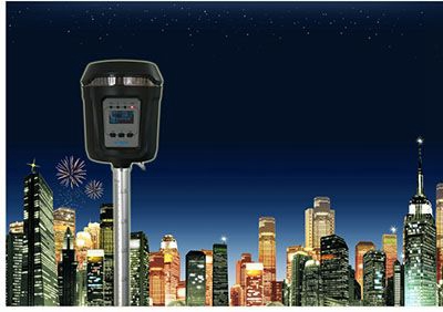
经营国内外各知名品牌的测绘仪器包括日本尼康、美国天宝光谱、瑞士徕卡、日本拓普康、日本索佳、日本宾得和国产的南方(瑞得、科力达、三鼎)、北京南得、博飞、苏光、大地、欧波、华星(中海达)、华测、赛特、莱赛等:全站仪、免棱镜型全站仪、GPS全球定位系统、陀螺全站仪、手持GPS、GIS采集器、电子/光学经纬仪、电子/光学水准仪、激光测距仪、红外测距仪、激光投线仪、激光垂准仪、激光指向仪、激光水平仪、激光隧道断面仪、测厚仪、海拔仪、罗盘仪、导航仪、工程检测尺、对讲机、工程计算器、钢卷尺、塔尺、脚架等多种仪器及配件。
3D激光扫描仪、无人机等新型装备,我们还提供智能GNSS、全自动全站仪在大坝、矿山、尾矿库的在线变形监测的解决方案,我们还为矿山系统提供包括瞬变电磁仪、电法仪等物探设备,以及矿山六大系统的装备和解决方案。
公司测量项目:
为客户提供工程测量、地形地籍测绘、房产测量、沉降变形监测测量、地籍考研、勘测定界、方量测算、GIS数据的处理及建库、地质灾害评估、矿产压覆、城镇规划、土地规划、土地整冶等项目的技术服务和项目技术承包。具有云南省国土厅、云南省测绘局和云南省住房与建设厅颁发的测绘资质、勘测定界资质、土地规划、土地整冶、地质灾害评估等相关资质,我们为水利、国土、矿山、房建、公路、铁路、规划、电力等行业的用户提供着周到和可靠的服务。中心现有技术人员40位,全部为相关专业的工程师或高校相关专业毕业生,具有较强的专业技术和良好的职业修养。经过数年的努力我公司为全国百家企事业单位提供了专业服务,积累了丰富经验。包括中交三航局、中铁十三局、中铁十七局、中铁二十一局、中铁建工集团、十四冶、云南建工、云南路桥等各大中型单位及昆明理工大学、西南林业大学、云南农业大学、昆明冶金专科、等高校建立了长期合作关系,并与省、地、市、区县的国土、水利、市政建设、园林规划、交通、政府采购等部门建立了广泛合作关系。
公司更注重用户个性化的需求,雄厚的技术实力确保广大用户的需要,公司力求以最可靠的质量保证、高的性能价格比、完善的售后服务参与有序的市场竞争,愿与各位同仁进行最广泛的交流与合作,从而达到与时俱进、共同发展的宏伟目标。感谢新老客户的惠顾与垂询,让我们用产品与服务架起一道彩虹,使我们之间永恒的诚信、友谊与进步更加绚丽,携手共创美好的明天。
Yunnan tiantuo surveying and mapping Co., Ltd. was registered in Kunming, Yunnan Province in 2013. After several years of efforts and development, the company has set up instrument 4S service center and measurement project technical service center, which is a professional chain service integrating the sales and maintenance of instruments and equipment to the technical contracting of measurement projects. Tiantuo company unites a group of young technical teams with ideals, ambitions and abilities. All the staff of the company have bachelor degree or above, and they are proficient in business, skilled in technology and have strong development ability. This is not only the solid foundation for the company's development, but also the basic guarantee to win the trust of users. Through our efforts, we have formed a business model of one company, two centers, separation of personnel and office, and really formed a professional service chain. We have branches in Dali, Baoshan, Pu'er and Lincang to provide more appropriate, timely and thoughtful services for our customers. "Focus on talents" and "user first" are two basic concepts of the company for internal and external. We sincerely hope that more talents will join our team and make every user satisfied is our goal. We sincerely hope to get the strong support from friends from all walks of life and put forward your valuable opinions. We are willing to work with all friends to support each other and develop together. Main products of the company: Surveying and mapping instruments of famous brands at home and abroad, including Nikon, Tianbao spectrum, Leica, TOPCON, soja, Pentax and Nanfang (Ruide, Kelida, sanding), Nande, Bofei, suguang, Dadi, oppo, Huaxing (zhonghaida), Huace, Saite, laisai, etc.: total station, prism free Type I total station, GPS global positioning system, gyro total station, hand-held GPS, GIS collector, electronic / optical theodolite, electronic / optical level, laser rangefinder, infrared rangefinder, laser line projector, laser plumber, laser pointer, laser level, laser tunnel section meter, thickness gauge, altimeter, compass, navigator, engineering measuring ruler, walkie talkie, engineer Cheng calculator, steel tape, tower ruler, foot stand and other instruments and accessories. 3D laser scanner, UAV and other new equipment. We also provide solutions for online deformation monitoring of intelligent GNSS and full-automatic total station in dam, mine and tailings pond. We also provide geophysical exploration equipment such as transient electromagnetic instrument and electrical instrument for mine system, as well as equipment and solutions for six mine systems. Survey project of the company: provide customers with technical services and project technical contracting of engineering survey, topographic cadastral survey, real estate survey, settlement and deformation monitoring survey, cadastral research, survey and delimitation, volume measurement, GIS data processing and database building, geological disaster assessment, mineral overburden, urban planning, land planning, land consolidation and metallurgy. With the qualification of Surveying and mapping, surveying and demarcation, land planning, land consolidation and metallurgy, geological disaster assessment and other relevant qualifications issued by the Department of land and resources of Yunnan Province, the Bureau of Surveying and mapping of Yunnan Province and the Department of housing and construction of Yunnan Province, we provide thoughtful and reliable services for users in water conservancy, land, mining, housing construction, highway, railway, planning, electric power and other industries. There are 40 technicians in the center, all of them are engineers of relevant majors or graduates of relevant majors in Colleges and universities, with strong professional skills and good professional training. After years of efforts, our company has provided professional services and accumulated rich experience for hundreds of enterprises and institutions in China. Including CCCC third Harbor Engineering Bureau, China Railway 13th Bureau, China Railway 17th Bureau, China Railway 21st Bureau, China Railway Construction Engineering Group, SMCC, Yunnan Construction Engineering Group, Yunnan Road and bridge and other large and medium-sized units, as well as Kunming University of science and technology, Southwest Forestry University, Yunnan Agricultural University, Kunming Metallurgy College and other universities, which have established long-term cooperative relations with the land, water conservancy and municipal construction of provinces, cities, districts and counties Design, landscape planning, transportation, government procurement and other departments have established extensive cooperation. The company pays more attention to the personalized needs of users, and has strong technical strength to ensure the needs of users. The company strives to participate in the orderly market competition with the most reliable quality assurance, high performance price ratio, and perfect after-sales service. It is willing to conduct the most extensive exchanges and cooperation with all colleagues, so as to achieve the grand goal of advancing with the times and common development. Thanks for the patronage and inquiry of new and old customers, let's build a rainbow with our products and services, make our eternal integrity, friendship and progress more brilliant, and work together to create a better tomorrow.
本文链接: https://brand.waitui.com/9724107bf.html 联系电话:请联系客服添加 联系邮箱:请联系客服添加


 浙公网安备 33011802001999号
