开元agriCAD品牌怎么样 申请店铺
外推网助力开元agriCAD品牌出海!将品牌入驻外推网,定制开元agriCAD品牌推广信息,可以显著提高开元agriCAD产品曝光,简直是跨境电商爆单神器!目前仅需1000元/年哦~

和意大利GPSKIT有限公司合资组建,主要从事精准农业GPS产品的生产、销售以及相关技术咨询、技术服务等系列工作的中意合资企业
内蒙古开元科技有限责任公司和意大利GPSKIT有限公司合资组建的中意合资企业,主要从事精准农业GPS产品的生产、销售以及相关技术咨询、技术服务等系列工作。
意大利GPSKIT有限公司zz 于农业硬件和软件的研发、设计、生产。通过精准的农业管理工作可以节省时间、节约能源、提高产量。公司技术团队在研发GPS卫星解决方案方面的经验已超过35年,拥有完整、科学的质量管理体系。已进入GPS卫星解决方案研究和开发领域的前沿行列,产品质量获得业界普遍认可。
内蒙古开元科技有限责任公司引进意大利GPS卫星定位产品技术有:自动驾驶、平地仪、测亩仪、道路GPS系统产品等。
一、GPS自动驾驶系统:该产品在农业工作中应用广泛,技术指标达到国际较为前沿水平。拖拉机配置该设备后,可实现无人驾驶,并且作业精准度控制在2-2.5厘米范围内。这项技术用于大面积耕作效率非常高。目前国内市场仅有几家自行设计生产的同类产品,有的同类国外产品也价格过高。拖拉机卫星自动导航系统适用于各种农作物的播种、收割、撒药、开地等工作,目前中国没有一家拖拉机制造商配备该技术,国内市场在这一领域目前基本属于空白,具有极大的市场发展空间。
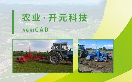
二、GPS平地系统:该产品是公司的战略性产品,是由意大利公司自主研发和生产,拥有自主知识产权的高新技术,在国内市场无同类产品。该产品主要用于开垦土地、平整土地、设计排水系统等,对玉米、棉花和水稻等农作物的种植尤其重要。
该产品技术精良,使用触摸屏电脑进行控制,产品质量、性能、技术指标达到国际同类产品较为前沿水平,价格适宜,具有竞争力。在国内市场上,符合我国农业土地工程的需求,竞争力强。
三、GPS测亩系统:该项技术主要用于土地测量及绘图技术,可以测量土地的各项数据,根据数据可制定相应的耕作计划。该产品体积小、便携带;具有性能稳定、操作简单等特点;对使用者而言,上手快、可操作性强。
Joint venture with Italy gpskit Co., Ltd, The Sino Italian joint venture established by Inner Mongolia Kaiyuan Technology Co., Ltd., a Sino Italian joint venture mainly engaged in the production and sales of precision agricultural GPS products, as well as related technical consultation and technical services, etc., is mainly engaged in the production and sales of precision agricultural GPS products, as well as related technical consultation and technical services. Italy gpskit Co., Ltd. ZZ is engaged in the R & D, design and production of agricultural hardware and software. Through precise agricultural management, time, energy and output can be saved. The company's technical team has more than 35 years of experience in developing GPS satellite solutions, and has a complete and scientific quality management system. It has entered the forefront of GPS satellite solution research and development, and its product quality has been generally recognized by the industry. Inner Mongolia Kaiyuan Technology Co., Ltd. introduces Italian GPS satellite positioning products and technologies, including automatic driving, grader, Mu meter, road GPS system products, etc. 1. GPS automatic driving system: This product is widely used in agricultural work, and its technical index has reached the international advanced level. When the tractor is equipped with this equipment, it can be driverless, and the operation accuracy is controlled within 2-2.5cm. This technology is very efficient for large-scale farming. At present, there are only a few similar products designed and produced by ourselves in the domestic market, and some similar foreign products are priced too high. The tractor satellite automatic navigation system is suitable for sowing, harvesting, spreading medicine and land opening of various crops. At present, there is no tractor manufacturer in China equipped with this technology, and the domestic market is basically blank in this field, with great market development space. 2、 GPS flat system: This product is a strategic product of the company, which is independently developed and produced by Italian company and has independent intellectual property rights. There is no similar product in the domestic market. The product is mainly used for land reclamation, land leveling, design of drainage system, etc., which is particularly important for the cultivation of corn, cotton, rice and other crops. The product has excellent technology, using touch-screen computer for control, and the product quality, performance and technical indicators have reached the more cutting-edge level of similar international products, with appropriate price and competitiveness. In the domestic market, it is in line with the demand of agricultural land engineering in China and has strong competitiveness. 3、 GPS acre survey system: this technology is mainly used in land survey and mapping technology. It can measure all data of land and make corresponding farming plan according to the data. The product has the advantages of small volume, portable belt, stable performance, simple operation and so on. For users, it is quick to start and easy to operate.
本文链接: https://brand.waitui.com/3a1c9525e.html 联系电话:请联系客服添加 联系邮箱:请联系客服添加


 浙公网安备 33011802001999号
